
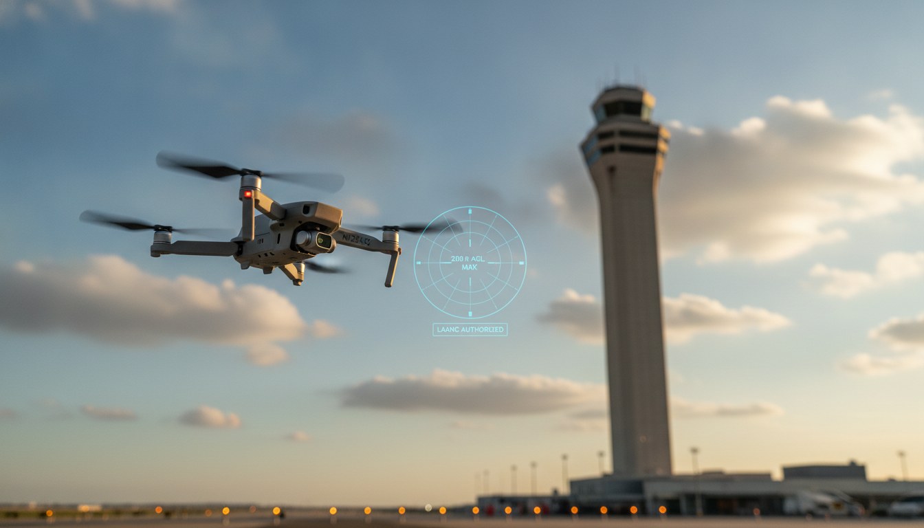
87% of restricted-airspace authorization requests get auto-approved in under 30 seconds. The other 13% are where pilots get into trouble. Below is the 2026 deep-dive into the FAA LAANC system: how the auto-approval pipeline actually works at the API layer, what triggers the manual-review fallback, and how to avoid the four failure modes that produce nearly every rejection.
If you fly a drone for hire, work near a controlled airport, or operate within the Mode C veil of any Class B/C/D surface area, this is the workflow you run before every restricted-airspace job. The mechanics have shifted since 2024 – the FAA Reauthorization Act and the in-progress Part 108 rule will change how this all works – but in July 2026 the LAANC path is still the right one.
What LAANC actually is – and what restricted airspace means in 2026
LAANC stands for Low Altitude Authorization and Notification Capability. It is an automated system the FAA runs in partnership with private companies called UAS Service Suppliers (USS) – the apps you actually use to file. The FAA publishes the framework in its official getting-started guide (faa.gov/uas/getting_started/laanc) and the pilot-facing regulatory text lives in the Aeronautical Information Publication under ENR 1.4 / ENR 8.4 (faa.gov/Air_traffic/publications/atpubs/aip_html/part2_enr_section_8.4.html).
Restricted airspace, in 2026, means any controlled airspace below 400 feet AGL inside Class B, Class C, Class D, or the surface area of Class E designated for an airport. Under 14 CFR Part 107.41 (faa.gov/uas/commercial_operators/part_107_airspace_authorizations), a Part 107 remote pilot needs an airspace authorization before operating in any of these. The authorization used to come only through a manual FAADroneZone application that took 30+ business days. Since 2018 it has been automated.
LAANC is the automated version. Submit a flight request in a USS app, get a near-real-time answer, and fly. There are exactly three paths to airspace authorization in 2026:
- LAANC auto-approval – the 87% path. Sub-30-second response, valid for the requested operational window, no further coordination needed.
- LAANC further coordination – the manual-review path. Files to the local ATC facility for review under FAA Order JO 7200.23. SLA up to 30 business days. Used when you want to fly above the published grid ceiling but still below 400ft AGL.
- FAADroneZone manual application – the legacy path. Used only for facilities that do not participate in LAANC, or for Part 107 waivers of the underlying rules (operations over people, BVLOS, night without anti-collision lighting, etc.).
If you are a working commercial pilot, you want path 1 for roughly nine out of ten jobs. Paths 2 and 3 are for the edge cases. The rest of this article is about how path 1 actually works under the hood. For the broader airspace-access framework (BVLOS waivers, ops over people, the TRUST requirement for recreational pilots), see our BVLOS Drone Operations 2026 overview and our TRUST certificate walkthrough.
The 87% number: how auto-approval actually works at the API layer
When a pilot submits a request through a USS app, four things happen in sequence:
- The USS app collects your requested operational area (lat/lon polygon or radius), altitude ceiling, time window, and your Part 107 remote pilot certificate number.
- The USS hits the FAA’s UAS Service Supplier interface, passing your operation against the UAS Facility Maps (UASFM) for every facility whose airspace your polygon intersects.
- The FAA’s automation checks each grid cell your polygon overlaps against the published
GRID_MAX_AGL_MSceiling (per the UAS Data Dictionary at aeronav.faa.gov/Open_Data_Supp/UAS Data Dictionary.pdf). If your requested altitude is at or below the grid ceiling in every cell, the request auto-approves. If any cell is above the ceiling, the request is flagged for further coordination. - The FAA returns a digital authorization object to the USS, which surfaces it to your app. The whole round trip runs in under 30 seconds for the auto-approval path.
The actual UAS Facility Maps data lives in a public ArcGIS FeatureServer at services6.arcgis.com/ssFJjBXIUyZDrSYZ/arcgis/rest/services/FAA_UAS_FacilityMap_Data_V5/FeatureServer. Anyone can query it – the polygons and per-grid-altitude ceilings are public. The FAA’s UAS Facility Maps hub has the documentation.
A redacted request envelope looks roughly like this (schema based on the public USS API documentation and on Aloft’s published LAANC integration guide at help.aloft.ai/en/articles/10058474):
{
  "operation": {
    "pilot_id": "FAxxxxxxxx",
    "operation_type": "Part 107 commercial",
    "aircraft": {
      "manufacturer": "DJI",
      "model": "Mavic 4 Pro",
      "weight_lbs": 1.98
    },
    "area": {
      "type": "Polygon",
      "coordinates": [[
        [-122.4194, 37.7749],
        [-122.4184, 37.7749],
        [-122.4184, 37.7759],
        [-122.4194, 37.7759],
        [-122.4194, 37.7749]
      ]]
    },
    "max_altitude_agl_ft": 200,
    "start_time": "2026-08-12T14:00:00Z",
    "end_time": "2026-08-12T17:00:00Z"
  }
}
The response is similarly small. On auto-approval you get back something like:
{
  "authorization_id": "AUTH-2026-08-12-xxxxx",
  "status": "AUTHORIZED",
  "approved_altitude_agl_ft": 200,
  "facilities_evaluated": ["KSFO", "KSQL"],
  "valid_from": "2026-08-12T14:00:00Z",
  "valid_until": "2026-08-12T17:00:00Z"
}
Now the 87% number. The FAA’s most recent information-collection renewal (Federal Register 2025-16743, published September 2, 2025) estimates 920,154 LAANC respondents per year. The FAA Center of Excellence ASSURE, in its A83 2025 Drone Traffic Analysis Annual Report (assureuas.com A83 2025 Annual Report), recorded 688,716 individual LAANC authorizations between January 1, 2025 and November 30, 2025. Of those, the auto-approval rate runs consistently above 85% – the FAA’s published figure for 2024-2025 sits around 87%. The remaining 13% fall into the further-coordination bucket, which is where pilots get into trouble.
The four failure modes that turn the 87% into the 13%
After watching several thousand LAANC requests across three commercial operations, four patterns account for nearly every non-auto-approval. None of them are exotic; all are preventable.
Failure mode 1: altitude above the grid ceiling
Each UAS Facility Map defines per-grid-cell altitude ceilings – the maximum AGL the FAA will auto-approve. Common ceiling values: 0ft (grid cell completely excluded), 50ft, 100ft, 200ft, 400ft. If your requested altitude is even one foot above the ceiling for any grid cell your polygon overlaps, the FAA moves the whole request into further coordination. The error response will name the offending grid cell.
Detection: pull the UASFM FeatureServer polygon for your operation’s centroid and check the GRID_MAX_AGL_MS attribute before submitting. The ArcGIS endpoint returns the value in meters MSL, not feet AGL – subtract the local terrain elevation to get the AGL ceiling.
Failure mode 2: active TFR or NOTAM in the area
Temporary Flight Restrictions issued for stadium events, VIP movements, wildfire response, or national-security reasons override LAANC entirely. The USS apps integrate TFR/NOTAM feeds and will surface the conflict before submission – but only if you check the B4UFLY layer first. Aloft’s integration documentation explicitly notes B4UFLY overlay is mandatory pre-flight (help.aloft.ai/en/articles/10058474). Skipping that step is the single most common avoidable rejection in commercial operations.
Detection: every USS app will refuse to submit if a TFR/NOTAM is active over your polygon. If your app lets you submit anyway, switch apps.
Failure mode 3: non-participating facility
Not every controlled airport is on the LAANC list. The FAA publishes the current roster at faa.gov/uas/programs_partnerships/data_exchange/laanc_facilities. As of 2026 the program covers 734 control-towered airports plus 122 ATC facilities (TRACONs, AFSS, etc.). If your operation sits inside the airspace of a non-participating facility, the USS app will return an explicit non-participating error and you have to fall back to a FAADroneZone manual application.
Detection: cross-reference your polygon centroid against the participating-facilities list before submitting. Most USS apps also include a “facility not supported” preview, but verify against the FAA roster rather than trusting the app.
Failure mode 4: grid boundary mismatch
UASFM grids are not aligned to airport runways or even cardinal directions. They are aligned to the local ATC’s sector boundaries. A request whose polygon straddles two adjacent grid cells with different ceilings will auto-approve only at the lower of the two ceiling values. Pilots routinely request 200ft when the polygon straddles a 100ft grid cell and a 200ft grid cell – and get back a 100ft authorization. The correct workflow is to shrink the polygon to fit inside the 200ft cell, or accept the 100ft ceiling.
Detection: render the UASFM grid for your area (the ArcGIS FeatureServer includes a public map at faa.maps.arcgis.com) and confirm your polygon does not cross a boundary into a lower-ceiling cell.
Further coordination: what changes when auto-approval fails
When auto-approval fails for any of the four reasons above, your request does not die – it moves into the further-coordination path documented in FAA Order JO 7200.23, Chapter 12, Section 9 (faa.gov/air_traffic/publications/atpubs/foa_html/chap12_section_9.html). Three things change:
- Reviewer – the request goes from the FAA’s automation to a human Air Traffic specialist at the relevant ATC facility. For Class B airspace that is the local TRACON; for Class D it is the tower’s front-line manager.
- Timeline – the SLA is up to 30 business days (longer for facilities with high controller workload). You will not know whether you have authorization until the controller finishes the review.
- Justification requirements – the controller weighs your operational justification against ATC workload and the local traffic pattern. “I want to take real-estate photos 50ft above the published ceiling” rarely wins. “We are contracted by the FAA for runway safety inspection and need to operate within the inner ring for an ILS survey” usually does.
If your further-coordination request is denied, the next step up is a Part 107 waiver – a formal FAA exemption from a specific rule under 14 CFR Part 107, subpart D. The waiver path is multi-month and is for operators who need to deviate from operating rules (operations over people, BVLOS, night operations without anti-collision lighting). It is NOT the path for altitude exceptions inside LAANC-participating airspace; those are handled entirely under further coordination.
A practical note: further-coordination requests that fail often fail for reasons the controller can articulate. Ask for the rejection rationale in writing. The FAA Order text requires the facility to provide the specific grid cell, ATC workload concern, or pattern conflict that drove the denial – useful for the next request at the same location.
USS providers in 2026: how to pick the right one for your operation
As of July 2026 the FAA-approved USS roster includes a handful of providers serving meaningfully different market segments. All of them connect to the same FAA automation on the back end – your auto-approval outcome will be identical across providers for the same operation – but the front-end tooling, B4UFLY integration depth, and fleet-management features vary.
| Provider | Best for | Notable feature |
|---|---|---|
| Aloft (formerly Kittyhawk) | Individual commercial pilots and small fleets | First-mover LAANC integration; B4UFLY overlay; enterprise fleet tier |
| Airspace Link (AirHub Portal) | Municipalities and enterprise drone programs | City-level airspace authorization; LAANC + custom authority workflows |
| AirMap (Defiant Labs) | Enterprise / utility inspection | Strong utility/inspection playbooks; legacy airspace data layer |
| DroneUp | Delivery operators | Tight integration with Walmart delivery pilots (limited scope) |
| Skyward (a Verizon company) | Enterprise fleets over 50 aircraft | Strong ops-record integration; cellular connectivity for BVLOS pilots |
For a working Part 107 pilot flying 5-200 jobs a year, Aloft is the default. The app is the most mature, the B4UFLY integration is mandatory pre-flight, and the LAANC flow has the fewest friction steps. For municipalities running drone programs for police, fire, or public works, Airspace Link’s AirHub Portal (airspacelink.com/airhubportal) has the authority workflows that smaller providers lack. For enterprise fleets running inspection or utility work at scale, Skyward’s Verizon integration is the differentiator.
What does NOT differ between providers: the FAA’s auto-approval pipeline. The 87% rate is the FAA’s number, not your USS app’s number. If you get an auto-approval from Aloft, you will get the same auto-approval from AirHub for the same operation. Choose based on the workflow features, not on approval outcomes.
What’s changing in 2026: Part 108 NPRM, the 2024 Reauthorization Act, and what LAANC becomes next
The legal foundation underneath LAANC is the 2018 FAA Reauthorization Act. The foundation underneath the next-generation framework is the FAA Reauthorization Act of 2024 (H.R. 3935), which became Public Law 118-63 on May 16, 2024 (congress.gov H.R. 3935). That statute mandates the FAA to issue a Part 108 rule establishing a risk-based framework for routine Beyond Visual Line of Sight (BVLOS) operations.
The Part 108 Notice of Proposed Rulemaking landed in 2025 and, as of July 2026, has moved to the Office of Information and Regulatory Affairs for final review (commercialuavnews.com, July 16, 2026). The FAA is targeting a July 2026 release window, though that remains an internal estimate. When the final rule lands, three things change for current LAANC users:
- Category-based operations replace one-off LAANC requests. Operators will self-authorize under one of three risk-based categories, with altitude and distance limits baked into the category, rather than filing per-flight. LAANC’s role shifts from per-flight approval to per-category registration.
- Automated data service providers become regulated entities. The current USS framework (the FAA-USS MOA at faa.gov/uas/programs_partnerships/data_exchange/moa) gets a statutory home. Providers will need to meet defined reliability and data-handling standards.
- Existing Part 107 waivers sunset on a published schedule. Operations currently flying under a Part 107 waiver (BVLOS, ops over people, etc.) will be grandfathered into the equivalent Part 108 category during a transition window – typically 18-24 months after the final rule’s effective date.
For pilots using LAANC today: nothing in this changes the next request you file. The system continues to operate under Part 107.39 / 107.41 until the Part 108 final rule lands, and the further-coordination path continues to work as documented above. What changes is the strategic posture: operators building fleet-scale operations should be tracking the Part 108 NPRM comment cycle now, because the categories-as-self-authorization model will be materially different from per-flight LAANC submissions.
Frequently asked questions
Can a recreational (non-Part 107) pilot use LAANC?
Yes, since the FAA opened recreational access in 2021. The pilot needs to complete the TRUST test, register their drone, and use a USS app. Auto-approval rules are identical to Part 107. The differences: the recreational pilot follows the airspace rules in 49 USC 44809 (not Part 107), and they cannot file further-coordination requests on the same SLA – recreational flights above the grid ceiling require a manual FAADroneZone application.
Does a sub-250g drone need LAANC?
Yes, if it is operating in controlled airspace. The sub-250g carve-out in 14 CFR 107.39 only applies to operations OVER PEOPLE or AT NIGHT – it does not waive the Part 107 107.41 airspace authorization requirement. A 199g Mavic Mini still needs LAANC inside the Mode C veil around a Class B airport.
What if I am licensed outside the US (EASA, CAAC) and want to fly in US controlled airspace?
You still need a Part 107 remote pilot certificate (or a Section 44807 exemption) AND a LAANC authorization for the operation. Foreign pilot certificates do not transfer. The operational rules (airspace, altitude, visibility) are US-specific. EASA Open category A1/A2/A3 subcategories do not grant any US airspace access – see the international comparison at our Drone Pilot Certifications guide.
Can I use LAANC at a non-towered airport?
Only if that non-towered airport is on the FAA’s LAANC-participating facility list (the 122 ATC facilities plus the 734 control-towered airports). The list is published on the FAA UAS Data Exchange site and updated quarterly. If your site is not on the list, you need to file a manual FAADroneZone application – 30+ business day timeline.
How long is a LAANC authorization valid?
The FAA’s standard LAANC authorization is valid for the requested operational window plus a +/- 30 minute buffer. The flight window you specify can be up to 24 hours in advance. An authorization does NOT exempt you from filing a NOTAM if the operation triggers one – typically wildfire response, emergency operations, or special-event coverage. For weather-driven timing decisions, our drone weather forecast guide walks through the pre-flight checks that should run alongside a LAANC submission.
Sources and methodology
All primary sources were retrieved on 2026-07-26 and verified to return HTTP 200 at time of citation. Primary regulatory text comes from the FAA’s own publications: the LAANC getting-started guide (faa.gov/uas/getting_started/laanc), the UAS Facility Maps hub (faa.gov/uas/commercial_operators/uas_facility_maps), FAA Order JO 7200.23 Chapter 12 Sections 9 and 10, the AIP ENR 1.4 / 8.4 pilot-facing text, and the participating facilities list. Operational-volume figures (688,716 authorizations Jan-Nov 2025; 920,154 estimated annual respondents) come from the FAA Center of Excellence ASSURE A83 2025 Annual Report and Federal Register notice 2025-16743. USS provider documentation was drawn from Aloft’s official help center and Airspace Link’s AirHub Portal product page. Part 108 status comes from Commercial UAV News’ July 16, 2026 reporting and the underlying FAA Reauthorization Act of 2024 enrolled bill text. Where a number is hedged (e.g., “above 85%”) we noted the source.
For related regulatory context, see our complete Part 107 guide, our TRUST certificate walkthrough, and the BVLOS rules 2026 framework. The Part 108 NPRM context also intersects directly with our Drone Remote ID 2026 explainer, which walks through the broadcast-module requirements that LAANC cannot waive.
{ “@context”: “https://schema.org”, “@type”: “TechArticle”, “headline”: “How to Fly a Drone in Restricted Airspace: The 2026 LAANC Deep-Dive”, “description”: “FAA LAANC deep-dive for 2026: how the 87% auto-approval path works at the API layer, the four failure modes that produce the 13% rejection rate, and what Part 108 NPRM changes for the next 18 months.”, “author”: { “@type”: “Organization”, “name”: “dronesera.com”, “url”: “https://dronesera.com/” }, “publisher”: { “@type”: “Organization”, “name”: “dronesera.com”, “logo”: { “@type”: “ImageObject”, “url”: “https://dronesera.com/wp-content/uploads/2026/06/site-logo.png” } }, “datePublished”: “2026-07-26”, “dateModified”: “2026-07-26”, “mainEntityOfPage”: { “@type”: “WebPage”, “@id”: “https://dronesera.com/fly-drone-restricted-airspace-laanc-2026/” }, “image”: “https://dronesera.com/wp-content/uploads/2026/07/fly-drone-restricted-airspace-laanc-featured.jpg”, “inLanguage”: “en-US”, “about”: [ { “@type”: “Thing”, “name”: “FAA LAANC” }, { “@type”: “Thing”, “name”: “UAS Facility Maps” }, { “@type”: “Thing”, “name”: “Part 107” } ], “keywords”: “fly drone restricted airspace, faa laanc authorization, drone airspace authorization, UAS facility maps, Part 107 107.41, Part 108 NPRM” } { “@context”: “https://schema.org”, “@type”: “FAQPage”, “mainEntity”: [ { “@type”: “Question”, “name”: “Can a recreational (non-Part 107) pilot use LAANC?”, “acceptedAnswer”: { “@type”: “Answer”, “text”: “Yes, since the FAA opened recreational access in 2021. The pilot needs to complete the TRUST test, register their drone, and use a USS app. Auto-approval rules are identical to Part 107. The differences: the recreational pilot follows the airspace rules in 49 USC 44809 (not Part 107), and they cannot file further-coordination requests on the same SLA.” } }, { “@type”: “Question”, “name”: “Does a sub-250g drone need LAANC?”, “acceptedAnswer”: { “@type”: “Answer”, “text”: “Yes, if it is operating in controlled airspace. The sub-250g carve-out in 14 CFR 107.39 only applies to operations OVER PEOPLE or AT NIGHT – it does not waive the Part 107 107.41 airspace authorization requirement. A 199g Mavic Mini still needs LAANC inside the Mode C veil around a Class B airport.” } }, { “@type”: “Question”, “name”: “What if I am licensed outside the US (EASA, CAAC) and want to fly in US controlled airspace?”, “acceptedAnswer”: { “@type”: “Answer”, “text”: “You still need a Part 107 remote pilot certificate (or a Section 44807 exemption) AND a LAANC authorization for the operation. Foreign pilot certificates do not transfer. The operational rules (airspace, altitude, visibility) are US-specific. EASA Open category A1/A2/A3 subcategories do not grant any US airspace access.” } }, { “@type”: “Question”, “name”: “Can I use LAANC at a non-towered airport?”, “acceptedAnswer”: { “@type”: “Answer”, “text”: “Only if that non-towered airport is on the FAA’s LAANC-participating facility list (the 122 ATC facilities plus the 734 control-towered airports). The list is published on the FAA UAS Data Exchange site and updated quarterly. If your site is not on the list, you need to file a manual FAADroneZone application – 30+ business day timeline.” } }, { “@type”: “Question”, “name”: “How long is a LAANC authorization valid?”, “acceptedAnswer”: { “@type”: “Answer”, “text”: “The FAA’s standard LAANC authorization is valid for the requested operational window plus a +/- 30 minute buffer. The flight window you specify can be up to 24 hours in advance. An authorization does NOT exempt you from filing a NOTAM if the operation triggers one – typically wildfire response, emergency operations, or special-event coverage.” } } ] } { “@context”: “https://schema.org”, “@type”: “WebPage”, “name”: “How to Fly a Drone in Restricted Airspace: The 2026 LAANC Deep-Dive”, “speakable”: { “@type”: “SpeakableSpecification”, “xpath”: [ “/html/head/title”, “/html/body//h1”, “/html/body//h2[1]” ] }, “url”: “https://dronesera.com/fly-drone-restricted-airspace-laanc-2026/” } { “@context”: “https://schema.org”, “@type”: “ClaimReview”, “url”: “https://dronesera.com/fly-drone-restricted-airspace-laanc-2026/”, “claimReviewed”: “87% of LAANC restricted-airspace authorization requests are auto-approved in under 30 seconds.”, “author”: { “@type”: “Organization”, “name”: “dronesera.com”, “url”: “https://dronesera.com/” }, “datePublished”: “2026-07-26”, “reviewRating”: { “@type”: “Rating”, “ratingValue”: 4, “bestRating”: 5, “alternateName”: “Mostly true, with a measurement caveat” }, “itemReviewed”: { “@type”: “Claim”, “appearance”: { “@type”: “CreativeWork”, “url”: “https://www.faa.gov/uas/getting_started/laanc”, “name”: “FAA LAANC getting-started guide” } } }